Unmanned Solutions to Save Lives
The Ukrainian Association for Humanitarian Demining and Recovery held a presentation of innovative technologies for humanitarian demining, developed by Ukrainian engineers and IT specialists.
The demonstration was attended by representatives of the Ministry of Economy, the Ministry of Defense, and UNDP, who were introduced to cutting-edge unmanned systems for surveying potentially contaminated areas and conducting demining operations. They also observed how software is used to analyze and classify detected explosive ordnance.
"Our enemy is inventive in methods of killing, saturating our land with mines and munitions. Ukraine is currently the most mine-contaminated country in the world. According to the Ministry of Defense, as of early 2025, 139,000 km² of Ukrainian territory is considered potentially hazardous. And it’s not only the scale of contamination but the density of explosives that presents a serious challenge for demining," said Andriy Savarets, coordinator of the Association.
Given this complexity, operators must plan effectively and reduce risks for deminers. This begins with a high-quality non-technical survey (NTS), an essential first step in identifying areas of concern. Before the full-scale war, NTS in Ukraine relied on traditional, time-consuming methods like visual inspections, interviews with locals, and analysis of old maps and military logs. But using only these methods would delay clearance for decades.
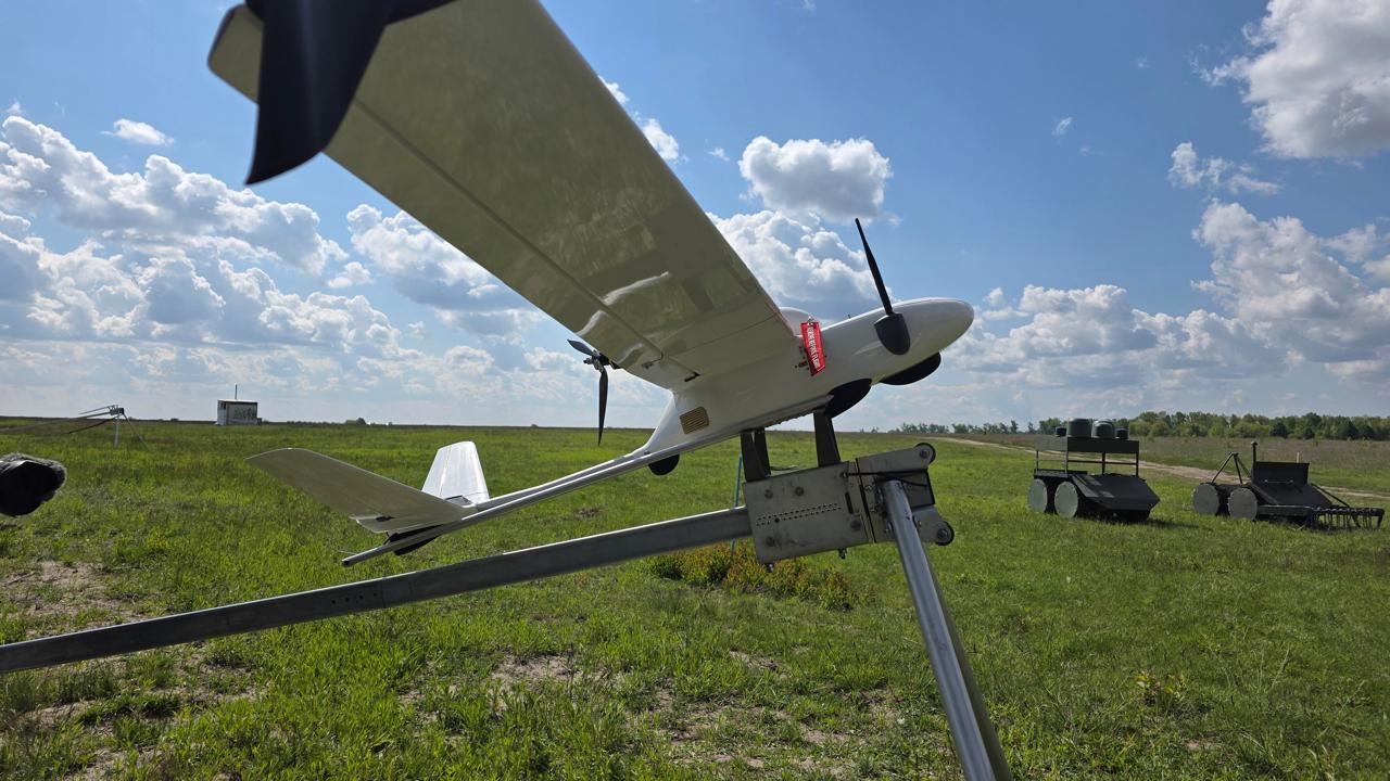
"Technology helps us move faster and safer. Today, NTS is conducted using UAVs. For instance, our member company DEF-C recently conducted a survey in Mykolaiv region using their own CETUS UAV and BEETLE multi-rotor system. Both are equipped with multispectral and thermal sensors. The results of aerial imaging are uploaded into the IRIZI Demining software, which processes the data — including using AI," added Savarets.
Ihor Bezkaravayny, Deputy Minister of Economy, emphasized that Ukraine is creating a mine action market — driving down costs and accelerating operations.
"We are leveraging our strength — modern technology, drones, satellite imagery. But the key is not just the flying platform. It’s the sensor collecting data and, even more crucially, the software that analyzes it," he said.
One such solution is IRIZI Demining — a full-fledged digital ecosystem for mine action.
"Our uniqueness lies in years of UAV experience for high-precision mapping and monitoring centers. From this foundation, we created IRIZI Demining — a tool for real-time communication, coordination, and monitoring across all mine action stakeholders," said Oleksandr Shutun, a representative of DEF-C. “We can upload maps, track clearance progress, and monitor which zones are actively being demined — down to the percentage of completion.”
Dmytro Yuferov, the developer of IRIZI Demining, noted that the software enables mine action operators to create detailed operational maps:
“During non-technical surveys, we identify and mark suspected hazardous areas. Operators can then plan more effectively, reducing risk and improving efficiency.”
Among the unmanned vehicles demonstrated for actual demining, the guests saw the “Zmiy” remote demining system, developed by Yuvitech and designed by engineers from Rovertech.
"Zmiy is designed for both humanitarian and combat demining missions. It can operate in coordination with drones, increasing precision and speed. It has already proven itself as a cost-effective, reliable solution for creating safe lanes for sappers,” explained the developers.
According to the Ministry of Economy, in the past two years:
- 35,000 km² of Ukrainian territory has been surveyed
- 5,000 km² were confirmed hazardous and entered clearance operations
Anushavan Arutyunyan, Head of the Association, closed the event:
“There is still an enormous amount of work ahead. Technologies continue to evolve, and our members remain focused on finding solutions that accelerate the restoration of safety and reduce the costs of demining in Ukraine.”